 BLUE MOUNTAINS – 7 September 2024
This was supposed to be an overnight walk with Nicole but, with the threat of rain, Nicole and I talked it over and came up with a day walk which was on both our wish lists – Haystack Ridge and the Haystack Neck – an interesting geological formation. Trish and Jim were both on board with the change and I talked Rob C (with the “should be easy” description) into joining us.
I’d heard of Haystack Neck from John G who said it was really cool and worth a visit. Then I attempted the walk a few years ago with Jim and Cheryl, and we encountered horrific scrub and turned back, with note to self “take secateurs next time”. So, this was unfinished business.
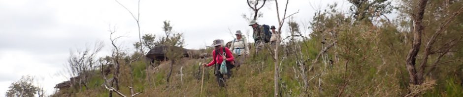
Confident that we could avoid the “horrific scrub” this time, the 1.5k walk on old fire trail, then 1.5k along a ridge sounded rather benign. So, we set off around 8.45am with four sets of secateurs between us, just in case.

We were soon at the end of the old fire trail on a large flat high point, consisting of approximately 300m of rock slab, most of which Jim and I had been to before. We came across this brick that we’d found the last time.

Close up of the brick, not sure what the ENF means, googled it but came up with nothing, if anyone knows what the ENF stands for, let me know. It doesn’t look that old and being a random brick at the end of a fire trail is curious.

Whilst the area is quite large (as I said around 300m across, there’s lots of vegetation on the rock platform.

Continuation of the tessellated rock platform with Mount Haystack in the distance.

Three of many sharpening groves found on the edges of the rock platform.

More sharpening groves.

We also came across three rock cairns (one of the three) which we followed.

Another of the cairns, these appeared to be quite old.
The cairns took us up a minor knoll, a mere 30m of elevation, arriving at the top at around 12 noon, encountering a bit of scrub necessitating some route finding, then got to the northern end of the knoll, so we took the time to stop for lunch. We then dropped down approximately 60m through some rocks to the base of a small cliff-line we passed through, we put some pink tape in a tree to identify the easy route up and down. Too far to the east, we set out to look for the saddle that we should cross, again, not horrific scrub, but still time-consuming tracking cross 150m of scrub.

We’re now at the end of a saddle before we are to climb Mount Haystack, we’ve negotiated approximately 1k of scrub, none of it “horrific”, but we made us of the secateurs clipping brush here and there, so we’d have an easy-to-follow route back.

And going up approximately 70m of elevation, was what did us in. The scrub was horrific, plus, the pollen from some of the vegetation caused an allergic reaction from two of us, and possible asthma from the allergic reaction. Plus, the scrub was so dense, that we had to take turns getting through the scrub, here’s Rob and Trish pushing through. Instead of Haystack Ridge, we started calling it Heartbreak Ridge (and other less gentile names).

Scrub and more scrub (photo: Nicole)

It took us two hours to get up and over Mount Haystack (in the background). Who would have thought it would be that hard. The descent wasn’t as hard, but by now, we’re running short of time. Here’s Jim on the edge of the saddle between the Mount and our destination, the Neck.

And here we are, looking at Haystack Neck, a saddle probably about 5-20m wide with cliff on either side. There was a drop of about a few meters to get down to the Neck. I didn’t think the exposed drop was worth it (nor did the others), so we just took pictures. I have to say, the Neck didn’t look as impressive as I’d imagined it. I didn’t expect as much vegetation on the Neck as there was and expected it to be flatter.

So, the turn around time, 2pm so we headed back, this is also a saddle between the neck and Mount Haystack, much easier to negotiate though.

Our fearless leader, Nicole, leading the group down.
We were able to follow our secateur route up the hill, across and down the other side without issue, and much quicker than it took to get there!

The start of the pass up to the top (photo: Nicole)

We looked at the route ahead and had thought about a more direct (and unknown) route, but then decided to find the way we’d descended (marked by Nicole’s pink tape), and once we found the route up, it was pretty straight forward.

Some of the not so horrific scrub, but still you could barely see me in the orange helmet! (photo: Trish)

Looking back at Mount Haystack, doesn’t look like horrific scrub, does it? (Photo: Nicole)

Me, looking out over the South Bowen Valley, stunning country (photo: Nicole)

Rod, looking back along our route (Photo: Nicole)
Our secateur route was a god-send, much quicker to get back to the fire trail – although I think that anyone coming after us might find it meandering sometimes.
We were back at the cars by 5pm (almost on the dot!). So, the stats … 6.8k round trip, approx 200m elevation, and approximately 8.45 hours.
Much harder than expected. Was it worth it? The views were pretty good when we were out of the vegetation, and the Neck was interesting, it completed the unfinished business and took one of the day walks off my Wish List … but never have to do it again! Thank goodness!
Big thanks to Nicole for leading the trip and doing all the navigation (which turned out to be a little more difficult than expected), and to Trish, Jim and Rob for joining us on this adventure. What next?
Here is a link for the route we took.
https://photos.app.goo.gl/zpvbE1Gi8iDSkuv4A