 BLUE MOUNTAINS NP – 14 February 2025
The weekend was supposed to be caving at Wombeyan, but storm damage had closed the park, and we didn’t find out for sure until 2 days before the trip. So, I scrambled around for a Plan B. Of the seven that had signed up for caving, four decided to do a canyoning adventure with me. Exploring Upper Du Faur Canyon, something none of us had done before. Trish and I didn’t have high expectations, so how hard could it be?
We dropped a car at the Mt Wilson fire station (the end of our adventure), then headed down to meet up with Nicole at the start of the walk off Bells Line of Road.
I had estimated that it would take 3 hours for us to walk the 3k off track to the creek, 3 hours for us to negotiate our way down 1.5k of canyon/creek and 2 hours to walk out, a total of 8 hours for the trip. I was navigating with map and compass – I told everyone that I didn’t want to know what their phones were showing them (ie where we were). It was a challenging route, difficult to see the way forward at times.

The start of the walk, with Polina, then Jim, Trish and Nicole.

Making our way along the ridge, dead easy, just make your way north. And then we had to do a quick turn east, make our way down off a high point. Unfortunately, I turned east too soon and we started down the side of the high point.

Fortunately, after 10 minutes I decided that we weren’t hitting the spur as planned and so we had to do a slight diversion north, and then our saddle and the next high point were obvious. Nice easy walking up the spur.

We’ve now been walking for 1.5 hours, and we were heading over to “high point 887” that you could see in the distance.

What we thought was high point 887. Seemed like the highest point around, right?

Initially we were going to skirt around the cliff, but we found this ramp that would take us up to the top where we could survey the way forward.
Using the map, nothing made sense. We sat down and had a snack and the only way we could figure what we were looking at was that we weren’t on High Point 887 (usually the highest spot around), but were actually on a rocky outcrop that was 900m (above sea level) and we were still looking over at high point 887 (which is where we had intended to be). Note to self, make a note about high point 900!
Nicole and I then oriented the map and everything became obvious, a short 150m over to High Point 887 and then a straight route for 500m to the creek.

Coming off High point 887 the going was really easy through open terrain.

We were at the creek about 2.5 hours after we left the cars, so we all changed into wetsuits (other than Trish who opted for thermals).

And we started down Du Faur Creek.
The write up in the Jamison book said “no abseils, lilo needed for 2 long lilo sections, one of 50m.” Not much so it was going to be interesting to see what the creek had n store for us. Nicole was the only one who took a lilo, it was a half sized one so was easy to carry when she wasn’t on it.

Heading down stream. It was at this point that we realised that this was Polina’s first canyon.

So far all’s well, we’ve been walking for about 45 minutes by now, and the cliffs either side of the creek are closing in on us.

Now it’s really closed in and we’ve come to our 1st swim.

And the lilo comes into its own.

Fabulous day, but not that warm. The creek’s opened up again.

And closing in again.

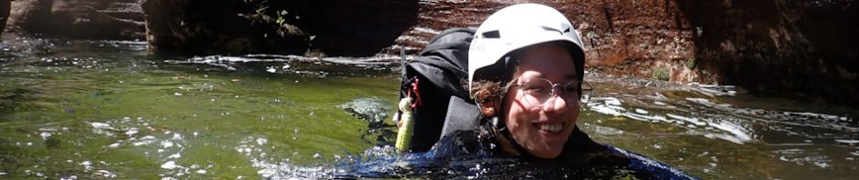
Our 2nd swim! The water is so clear.
It was shortly after I took the photo above that we came to our first real challenge, a Beaver Dam (not that we have Beavers in Australia, but it was a big block up of flood debris). We couldn’t climb over it, or around it, took about 1/2 an hour to make that decision. Trish had gone under it first, it was like swimming through a huge pick up sticks muddle. Polina and Jim gingerly made their way through, and we sent a few packs through, but I was worried about sending Nicole’s pack through, it was quite bulky and I was worried that it would bring logs and sticks down on us. I swam back about 50m to see if there was a way we could climb out and go around the dam, but the only way out was dodgy, so we swam back, Jim found a way to come over the top (sort of) and grab Nicole’s pack and the lilo, so she and I then made our way through – very nerve racking.
Shortly after the beaver dam was a 2m jump into a deep pool. This was Polina’s first real jump so she was very nervous. I said to her if I could do it (a great grandmother), then she’d be fine, we actually sat down on the rock and just “fell” into the water which was followed by a 20m swim!
We were all pretty cold by now and it was around 12.45pm so we stopped for a quick lunch in the sun, wasn’t very warm though, a nasty wind blowing down the canyon.

After lunch and we came to this nice rock shelf to walk along, shortly after this photo, a strange snake crossed over the rock right in front of Trish and entered the flood debris. Heart stopping! Up until the snake episode I’d though it would have made a better lunch spot.

Our 2nd “jump” was a little challenging, you had to negotiate your way along the slot and then drop about 1m into the pool. Jim went in first to suss it out and then Polina bravely went in next. We sent most of the packs ahead as I thought they might get stuck in the slot. Jim was at the bottom to make sure we all dropped in safely.

Another challenge, climbing down this rock face. We set up a hand line to make it safer, and the rock, thankfully was quite grippy.

We’re now into a good canyon section.

Beautiful wave rock formation in the canyon section.

The first of the bigger swims which was supposed to be about 50m but I think it was more like 100m. It was very pretty though particularly when it got darker.

We came to this flood debris, and Jim moved it, I was worried that we’d touch it, or something under the surface would move and it would fall on top of one of us.

Another challenge, too big to negotiate out way down, so we found a big log and set that up so we could sit on it and then we had a hand line which enabled us to make a controlled descent (of about 2m).

Jim retrieving the hand line.

Another big swim, this one about 30m.

Polina about to go around a corner.

We then came to an overgrown part of the creek, which was actually a relief to walk through, rather than swimming.
We knew we should be near the exit by now, but it turns out I was looking for a different spot to what I was looking for (an open area with a small waterfall beside it), thankfully Jim thought we were at the right spot. I wasn’t at all convinced, but he made his way up this side creek and then yelled out that he’d found the exit.
I didn’t take any photos of the exit, it was basically up a crack in the cliff, crawling over some rocks at the bottom and then using a fixed hand line (down from a big tree) to make the 8m climb up the cliff. Everyone else used the fixed hand line but I decided Jim could fix a rope for me and I’d prusik up, and then Trish attached herself to the rope and we top belayed her up to safety.
We were at the top of the cliff at roughly 4pm, changed out of our wet suits and then headed off on the well-defined track to the fire trail (about 1+k of track walking).

This was interesting. I’d sent off Nicole, Trish and Jim to recover the cars parked down at the start of the walk, and Polina and I headed along at our own (well, really my) pace. We came to an intersection, one fire trail went down this one was flat, so we decided on the flat one. Not sure whether or not it was private property, but it was lovely and flat, a pleasure to walk. We got back to the fire station at 6pm.
So, how far off was I from my estimate of 8 hours? Well, we did it in 9 1/2 hours … there was a lot of stopping and starting on my side (checking map, taking new bearings and trying to figure out about High Point 887), so that was about 1/2 an hour of stuffing around. We spent about 1/2 an hour at the Beaver Dam, and that was justified, and then probably another 1/2 hour at the down climb and the controlled climb down. I was probably slower walking out too. I’m sure that a younger fitter group would do better, but we were safe, and we enjoyed the trip.
It was far more challenging than any of us had expected, I thought it would be just a walk down a creek (as did Trish and Jim), I think everyone had a great time. Would I do it again? Not the whole trip, although we have been mulling over a trip down October Creek in the future and doing the 2 big swims again, then heading further down stream.
Big thanks to Jim (our token male), Nicole, Trish and Polina (you did so well!). Couldn’t have done the trip without you and it was a great adventure!
I need an Australian glossary. What is a lilo?
I did not know that you did not have beavers over there. Makes sense since you have so many exotic animals and birds!
I lilo is a blow-up mattress that is waterproof so you can blow it up and float on it.